


DecaMaps app for iPhone and iPad
Developer: MEDIA NAVI,Inc.
First release : 15 May 2013
App size: 11.02 Mb
Create a large detailed map at once!
+++++ features +++++
- DecaMaps is an iPhone and iPad app to create a large detailed map.
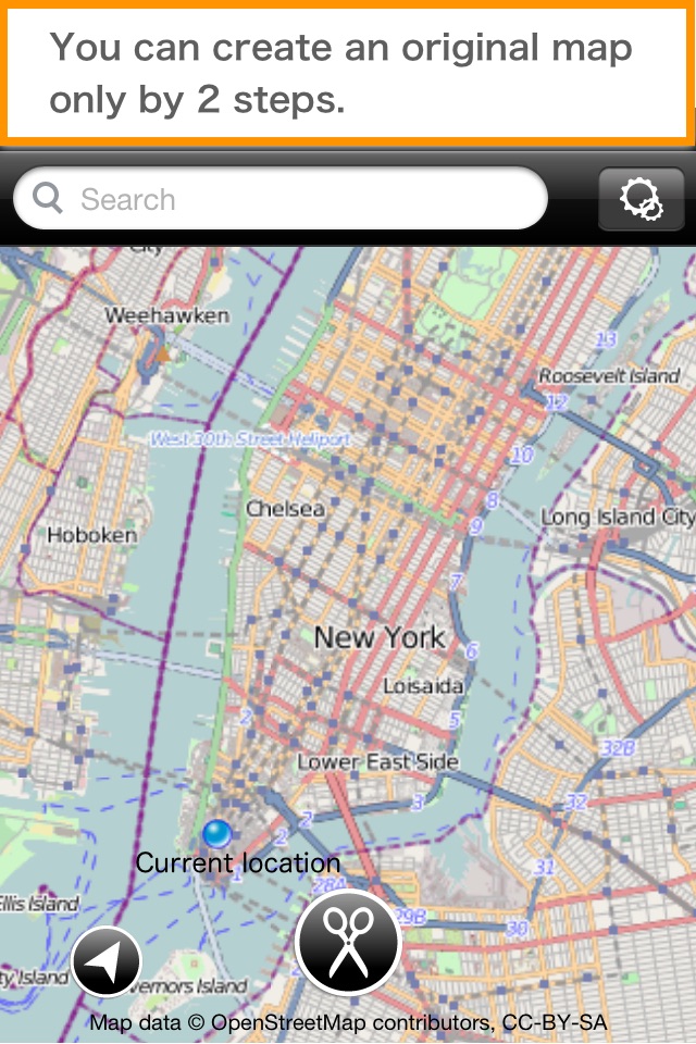
You can create an original map only by 2 steps.
Step1. Decide an area on the map.
Step2. Tap the scissor button.
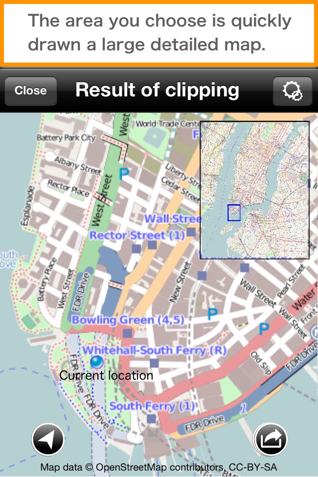
The area you choose is quickly drawn a large detailed map.
- Easy preview
You do not need to zoom in or out to the map. Your iPhone or iPad shows you a large map and a detailed map on the same screen.
- Print a large map!
You can print out a large poster up to 16 sheets of paper.
*Supported paper size: A4/Letter/B4/B5
*Purchase a “large poster print add-on” to print a more than 4 sheets of paper (2 sheets x 2 sheets). (Ad will be removed if you purchase the add-on.)
*To print posters, you need a printer that is compatible with AirPrint on the same Wi-Fi network connected with iOS device.
- You can also save the map to Camera Roll.
Up to 26,000,000 pixel map can be saved as an image file.
*On specification of Camera Roll, saved image cannot zoom in enough, but the original image does not become depleted.
Save the image to your PC and see it or view with an iPhone app that supports with high resolution image.
+++++ "DecaMaps" is useful for +++++
If you print out a large map by yourself, it is very useful for below situations.
- Confirm the place where you have never been before.
- For pre-confirmation of travel destination or use as a travel guidebook
- Print out the places where you have been to or have grown up and enjoy the sight of them
- For an evacuation map, an assistant return home map
- For a driving map
- For check a school route for your child/children
- For an event, a lecture presentation
Latest reviews of DecaMaps app for iPhone and iPad
On iPhone 7 plus.
Works great. Handy tool to have.
Great idea, but falls short of needed options. Has ZERO configurability. *No ability to select output size or dimension (you "get" what it "gives" you) *No way to select "type" of map. Only offers a basic street map - No satellite or Hybrid option?! *Prints a goofy logo on EACH PAGE "OpenStreet Contributors" (which NEED NOT BE DONE since it is being assembled into ONE map (right?). Only needs to be printed on ONE sheet. Has great potential when app is finished and fixed, but not now. Not Ready for Prime Time.
This app does print a map in multiple pages, and has great alignment printing on each page so I can be made into a huge map. The instructions are pretty much nonexistent, and you have to play around to make test prints to figure out how the interface works. It looks to me like the map is somewhat old and in many parts of the world out of date. I will say it is better than nothing. It does work and it makes a fairly good map if youre desperate. But you only get one style of a map there are virtually no options anywhere.